


![]()
![]()
Trail Between the Lakes – GPS Waypoints
in Sabine National Forest
We present the GPS (Global Positioning System) waypoints for each mile marker on the Trail Between the Lakes. These were recorded by the troop in January, 2001. Also is the GPS position for the nearest hospital.
UPDATE: January, 2002 – the scouts of Troop 204 have surpassed themselves! If you’d like to see their set of topographic maps of the Trail Between the Lakes annotated with the mile marker positions, check them out on their website at https://www.bsatroop204.org/Backpacking/Trails/TrailBetweenTheLakes.htm The maps have a complete GPS trace of the trail. Great job, guys!
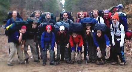
Troop 204 on the Trail Between the Lakes
With great appreciation to…
BSA Troop 204
The Woodlands, Texas
Sponsor: Sts. Simons & Jude
Trail Between the Lakes | ||||||
Mile Post | North Latitude | West Longitude | Mile Post | North Latitude | West Longitude | |
|---|---|---|---|---|---|---|
0 | 31.26122 | 93.67949 | 15 | 31.26918 | 93.86897 | |
1 | 31.26890 | 93.69100 | 16 | 31.26937 | 93.88292 | |
2 | 31.27550 | 93.69700 | 17 | 31.27108 | 93.89813 | |
3 | 31.27221 | 93.71223 | 18 | 31.26427 | 93.90895 | |
4 | 31.26773 | 93.72529 | 19 | 31.25505 | 93.91985 | |
5 | 31.26864 | 93.73650 | 20 | 31.24281 | 93.92313 | |
6 | 31.26594 | 93.75095 | 21 | 31.23248 | 93.92723 | |
7 | 31.26357 | 93.76205 | 22 * | 31.21980 | 93.92960 | |
8 | 31.26932 | 93.77445 | 23 | 31.21504 | 93.92796 | |
9 | 31.26963 | 93.78869 | 24 | 31.20300 | 93.92724 | |
10 | 31.26699 | 93.80202 | 25 | 31.19560 | 93.94370 | |
11 | 31.26670 | 93.81489 | 26 | 31.19030 | 93.94980 | |
12 | 31.26812 | 93.83083 | 27 | 31.18160 | 93.96000 | |
13 | 31.26772 | 93.84036 | 28 | 31.17770 | 93.97197 | |
14 | 31.26829 | 93.85400 | Hospital | 31.35593 | 93.82091 | |
* Estimated location of mile marker as the marker was missing | ||||||